Volcanic Activity Affecting Less Than 1% of Big Island’s 4,028 Square Miles of Natural Beauty
When planning a trip to the Big Island of Hawai‘i, or considering a purchase there, it’s important to note the following:
- Lava flows are currently affecting less than 1% of the Big Island’s land mass
- The lava flows and volcanic activity span only 25-30 square miles
- Hawai‘i Island is 4,028 square miles in size (almost the size of Connecticut)
- The volcanic activity is restricted to the lower Puna area, which is about 100 miles from Kailua-Kona
- Dr. Virginia Pressler, Hawai‘i’s Department of Health Director has declared the air quality for the vast majority of the Hawaiian Islands to be “clean and healthy” and has said that when tradewinds are blowing, “… the vog and ash routinely move in a southwesterly direction and out to sea away from the Hawaiian Islands.”
- Shield volcanoes and stratovolcanoes behave in entirely different ways
#Kilauea lava channels are clearly visible in this #Sentinel2 B image of the #Hawaii volcano from 23 May (crop and full image). Follow @USGSVolcanoes for updates. pic.twitter.com/ZSCeL81xEB
— ESA (@esa) May 25, 2018
Tweet courtesy of the ESA (European Space Agency)
Governor Ige & the State Department of Health On Air Quality
We want to stress that the effects of lava, vog and ash are predominantly isolated to the lower Puna area. According to Dr. Virginia Pressler, Hawai‘i’s Department of Health Director, normal tradewinds are keeping the rest of the Big Island safe. In a press release from the Hawai‘i Tourism Authority, dated May 25, 2018, Dr. Pressler noted, “The air quality for the vast majority of the Hawaiian Islands is clean and healthy. The emissions from Kīlauea volcano are a non-factor for O‘ahu, Maui, Moloka‘i, Lāna‘i and Kaua‘i. The weather is beautiful and warm with cooling trade winds everywhere in Hawai‘i and is exactly what travelers expect when coming here for a relaxing and fun vacation experience. This includes Hilo, Pāhoa and the Kona and Kohala coasts on the island of Hawai‘i.”
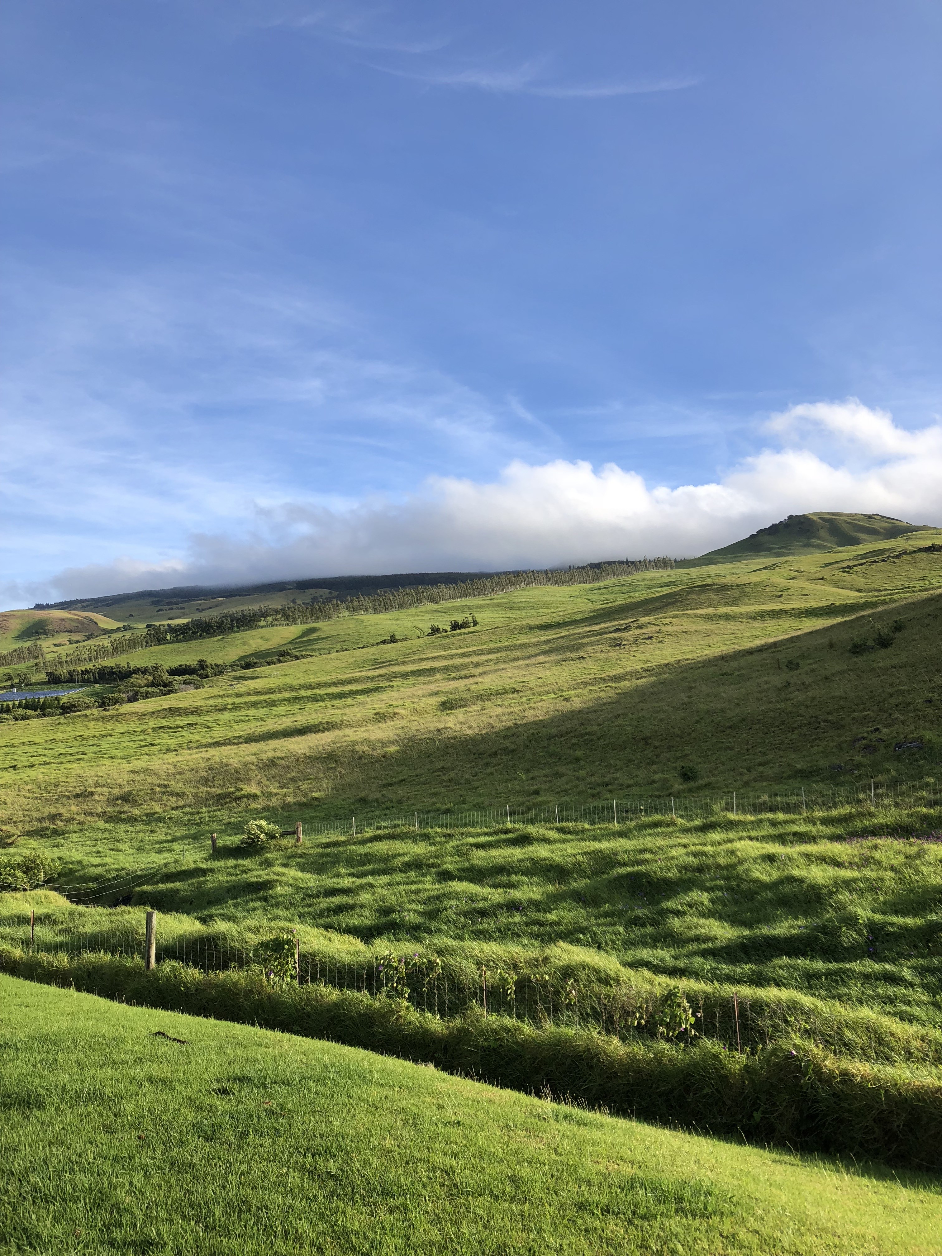
Thursday morning, May 31, 2018 – Waimea (Kamuela), Big Island of Hawai‘i. Photo credit: Bob Chancer
In the same press release, Hawai‘i’s Governor David Ige stated, “Hawai‘i’s air quality is being closely monitored on a continuing basis by scientists, meteorologists and the Hawai‘i State Department of Health. This team of experts says the air quality in the Hawaiian Islands is safe for residents and visitors, except in the affected areas.” He continued,“The bottom line is that there is no reason for travelers to avoid making their vacation plans in the Hawaiian Islands due to safety concerns because of Kīlauea volcano. Visitors will be welcomed with open arms and treated to the hospitality, aloha, warmth and natural beauty that is found everywhere in Hawai‘i. The only area to avoid is lower Puna where the eruption is ongoing.”
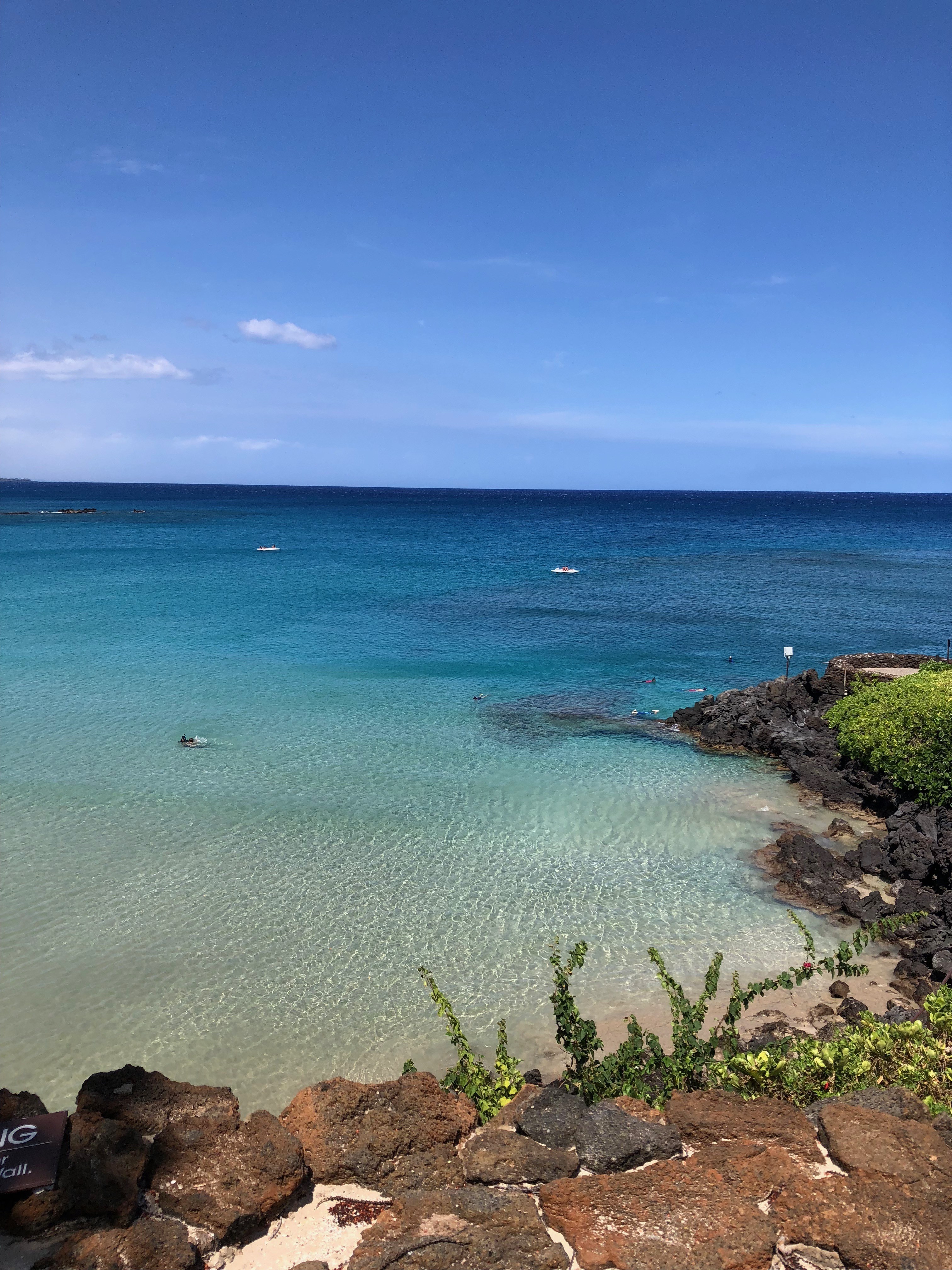
Thursday morning, May 31, 2018 – Kauna‘oa Bay, Big Island of Hawai‘i. Photo credit: Bob Chancer
President & CEO of the Hawai‘i Tourism Authority Welcomes Visitors
George D. Szigeti, president and CEO of the Hawai‘i Tourism Authority (HTA), echoed the governor’s sentiment in welcoming visitors to Hawai‘i. “We understand the concern some travelers may have about coming to Hawai‘i while Kīlauea volcano is so much more active at this time. But we encourage everyone to do their research and rely on trusted federal, state and county resources that are providing truthful, accurate information about what is taking place in Hawai‘i. Those who do will find that coming to Hawai‘i is a smart decision to enjoy a wonderful summer vacation.”

Thursday morning, May 31, 2018 – Kauna‘oa Bay, Big Island of Hawai‘i. Photo credit: Bob Chancer
Who Is Being Affected?
It’s true that more than 1,700 residents in the Leilani Estates and surrounding community have been displaced from their homes. We are holding a fundraising appeal through our nonprofit arm, the Hawai‘i Life Charitable Fund, to assist with their needs.
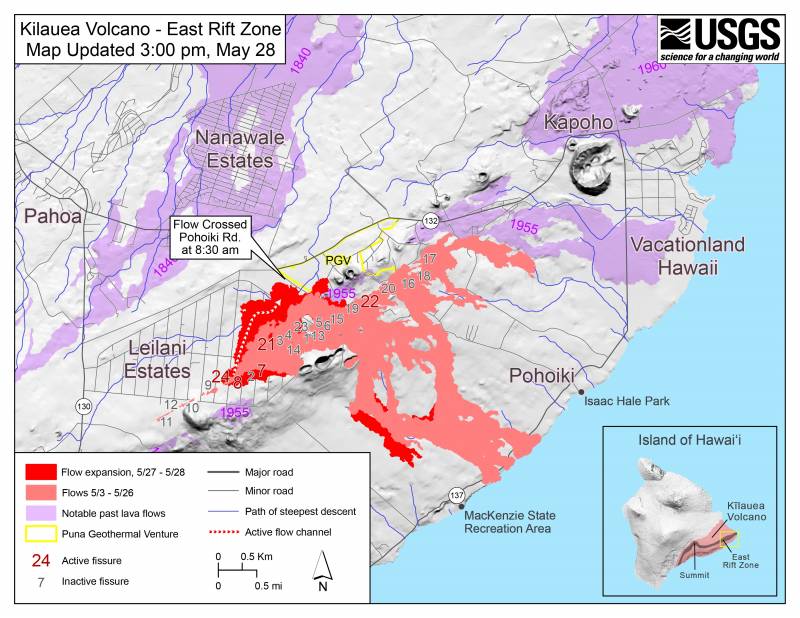
Volcanic Activity Maps – Just 1% of the Big Island Is Affected
Here’s a Google map that you can toggle, zoom in and zoom out, for reference. Typically, the vog and ash are blowing offshore and out to sea in a southeasterly direction:
Here’s an aerial view of the Big Island of Hawai‘i, provided by the United States Geological Survey (or USGS). It clearly shows the relatively small size of the East Rift Zone and the Puna area in the tiny yellow bounding box, within the thumbnail at bottom right.
For The Latest Updates & Other Resources
To learn more about geology and the difference between (mostly oozing) shield volcanoes and stratovolcanoes, check out our recent post Is The News Hurting Hawai‘i Island More Than The Volcano?
For the latest update on air quality in the Hawaiian Islands, please reference the State of Hawai‘i Interagency Vog Information Dashboard. For the latest tourism updates please visit the Special Alerts page of the Hawai‘i Tourism Authority:
Travelers planning a trip to the Hawaiian Islands who have questions can contact the Hawai‘i Tourism United States Call Center at 1-800-GOHAWAII (1-800-464-2924).

Thursday morning, May 31, 2018 – Puako, Big Island of Hawai‘i. Photo credit: Katie Minkus
Leave your opinion here. Please be nice. Your Email address will be kept private, this form is secure and we never spam you.